
Finding the source of the Thames
You’ve reached your final destination
Tuesday lunchtime. The end of a business meeting in Cirencester and a dull drive back to London beckoned and the sense of four hours wasted in the car.
What better time then to find something worthwhile to add some spice to the working day. A hasty Google of the area and there it was. Nearby was the source of The Thames – what better way to offset a drive back to its final destination over 200 miles of winding river to the east.
Now you’d think it would be easy to find the source of such a famous river and that there would be a visitor centre, parking and signs for miles. Thankfully it’s much more subtle and surprisingly hard to spot from the road.
Location of the source of the Thames
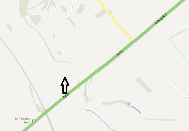
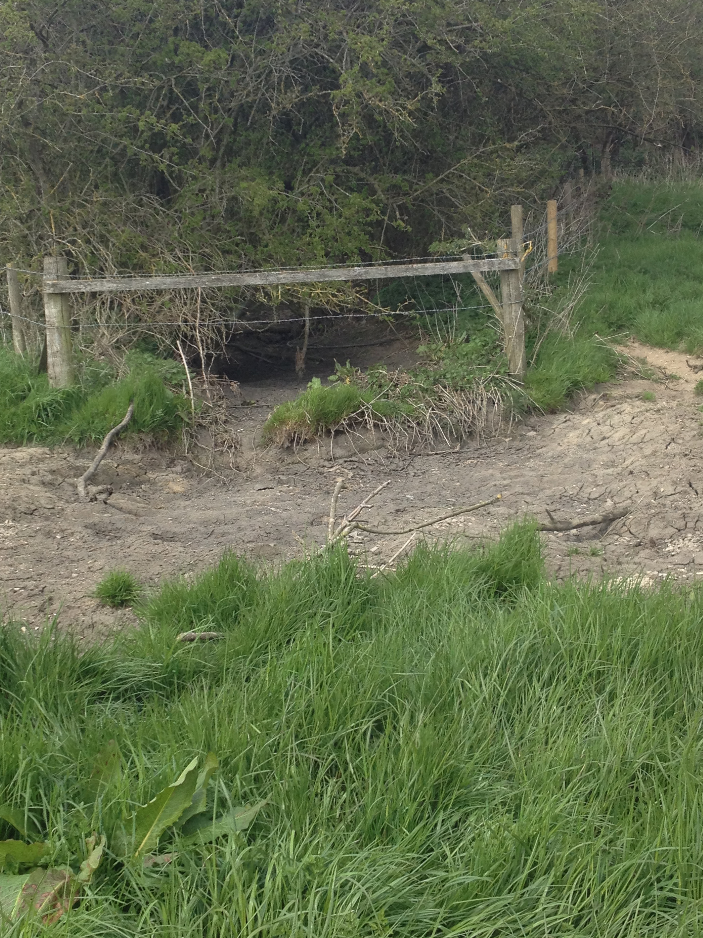
The Thames originates to the south of the picture-postcard Cotswolds, just to the north of the A433 in a pretty, if nondescript, field. The entrance to the field is not obvious when driving past and indeed I had to park somewhere nearby in a side road a few hundred yards away and walk along the side of the pavement-free road until I found a small wooden sign indicating The Thames Path. If you’re heading west and you go under the railway bridge and past The Thames Head pub you’ve gone too far.
Better still is to head further south and pick up the Thames Path earlier near the villages of Ewen to the east or Kemble to the west where you may find somewhere better to park and enjoy a longer if more clearly signposted walk.
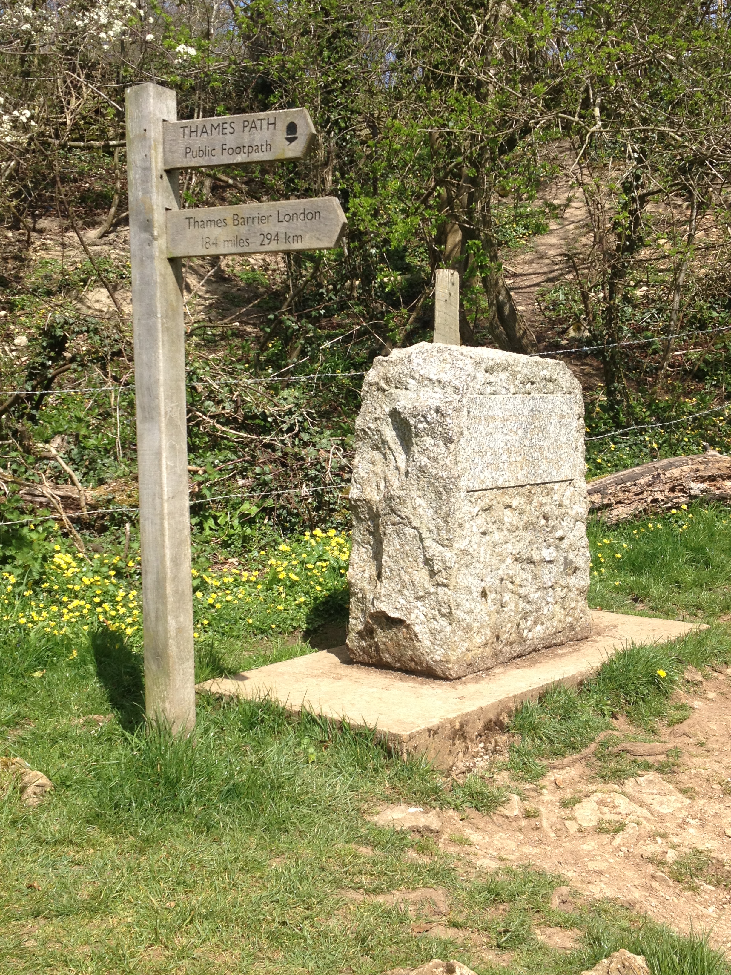
When you cross over the A433 on the Thames Path you meander through a couple of fields and there beside an ash tree is a stone slab with a plaque indicating the source of The Thames and a sign showing the distance to the Thames Barrier – 184 miles.
Those keen cyclists among us will be disappointed if you fancy making the trip east on a cycle tour. Cycles are only permitted on short stretches of the route, a missed opportunity when you consider the wonder that is the Loire à Vélo trail across the channel that allows you to cycle just about every inch of that wonderful river.
Near the stone slab, there’s a small circle of stones with a pile of rocks in the middle but no water. In fact, as you trek south you’ll do well to see any water at all for miles, particularly in summer. When I was there after a very wet spring there was only a dry riverbed found on the other side of the A433 as you’ll see in the pictures.
Final thoughts
It may not be quite up there with the discovery of the source of the Nile, but as working Tuesday afternoon’s go, this made for a beautiful and memorable way to spend a lunchtime. With more time, it would be have been wonderful to progress further and find the first traces of muddy water a few miles to the south. However, it doesn’t matter, it’s about doing something different with the time you have available even if you only have a rushed hour and a sandwich in your pocket…
Head north from this point and you’ll find it
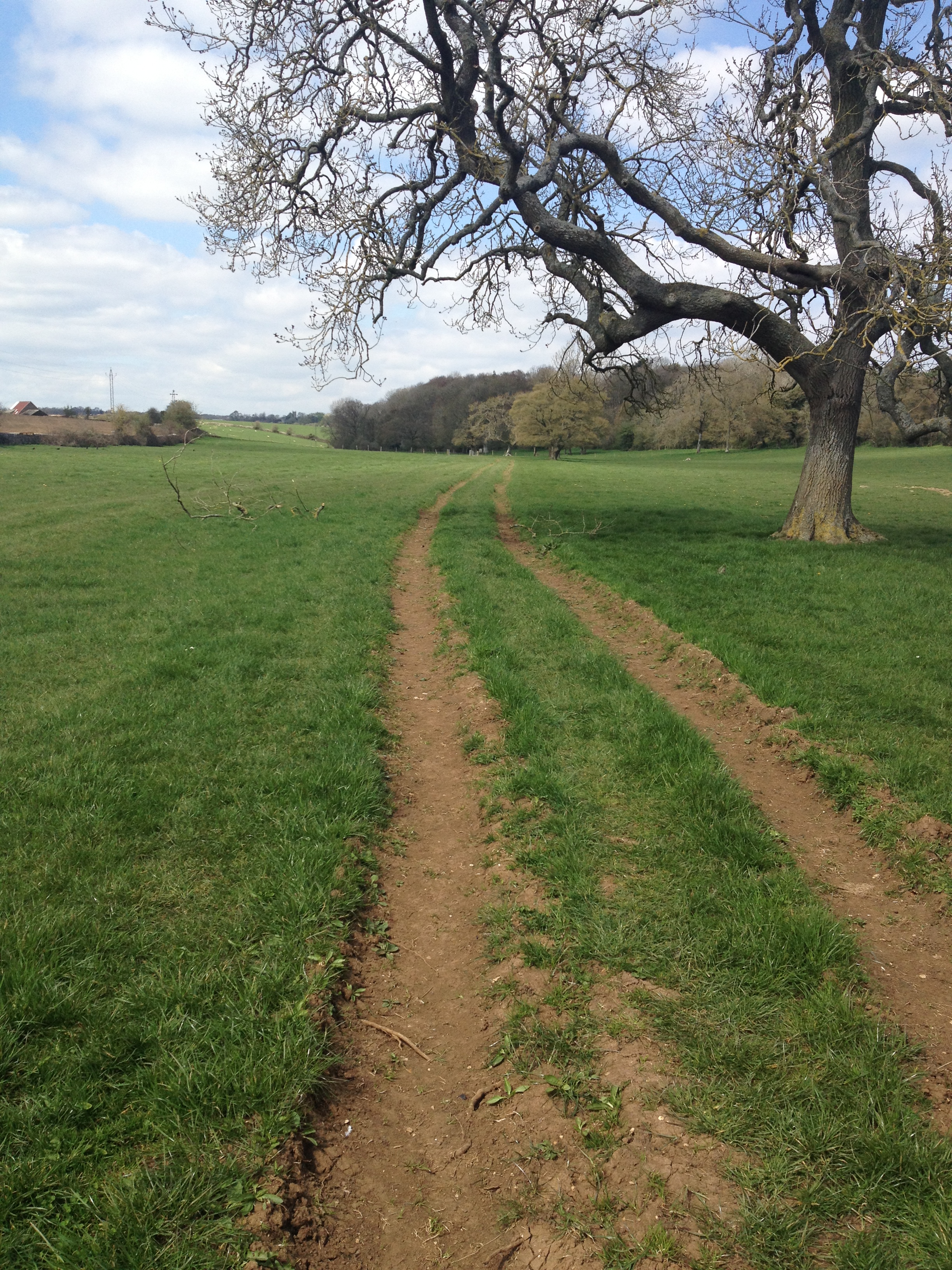
Head north along this track

More of a shrine than an actual spring
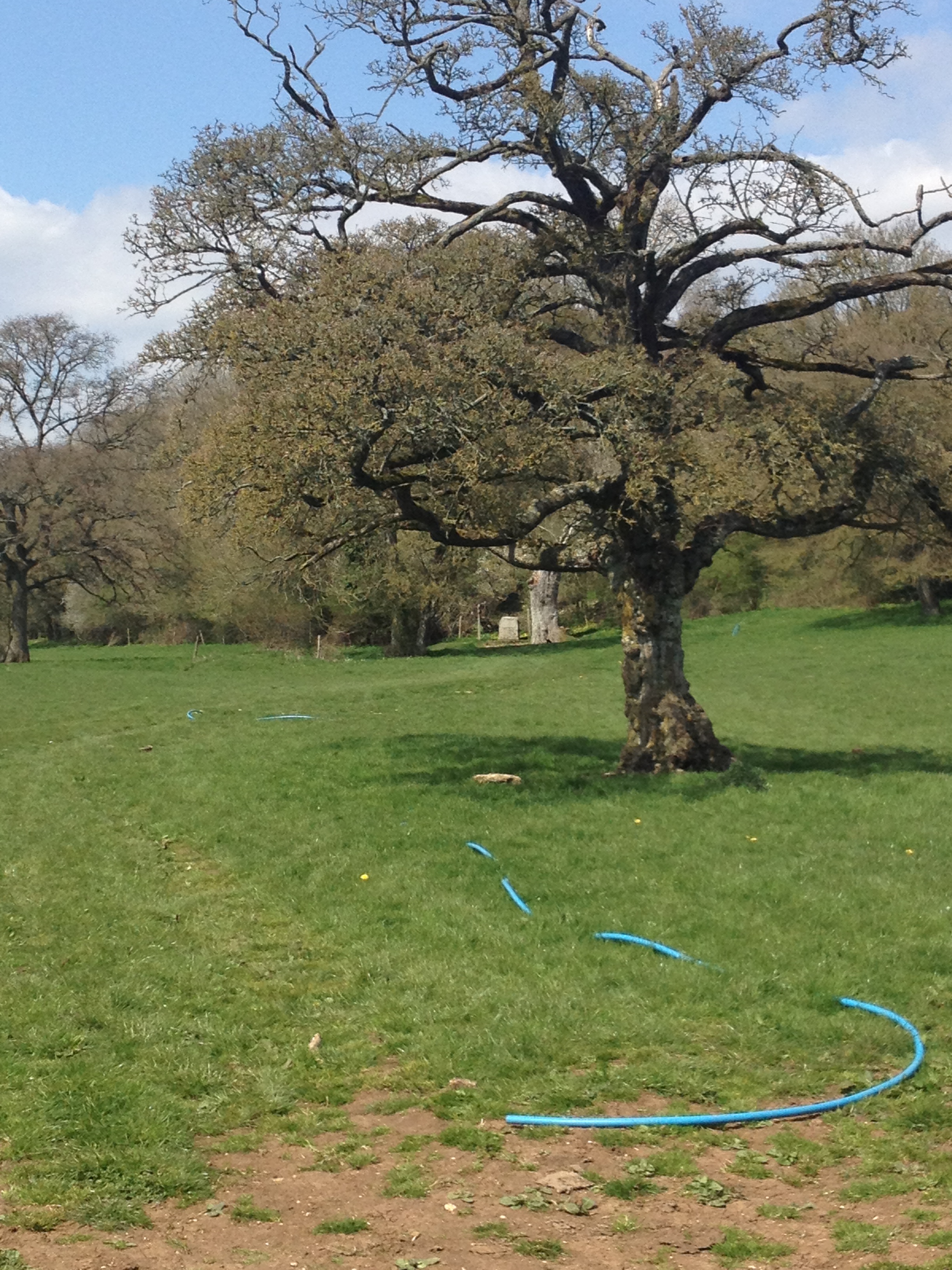
Who knew the Thames water came from a hose?
The start of the riverbed
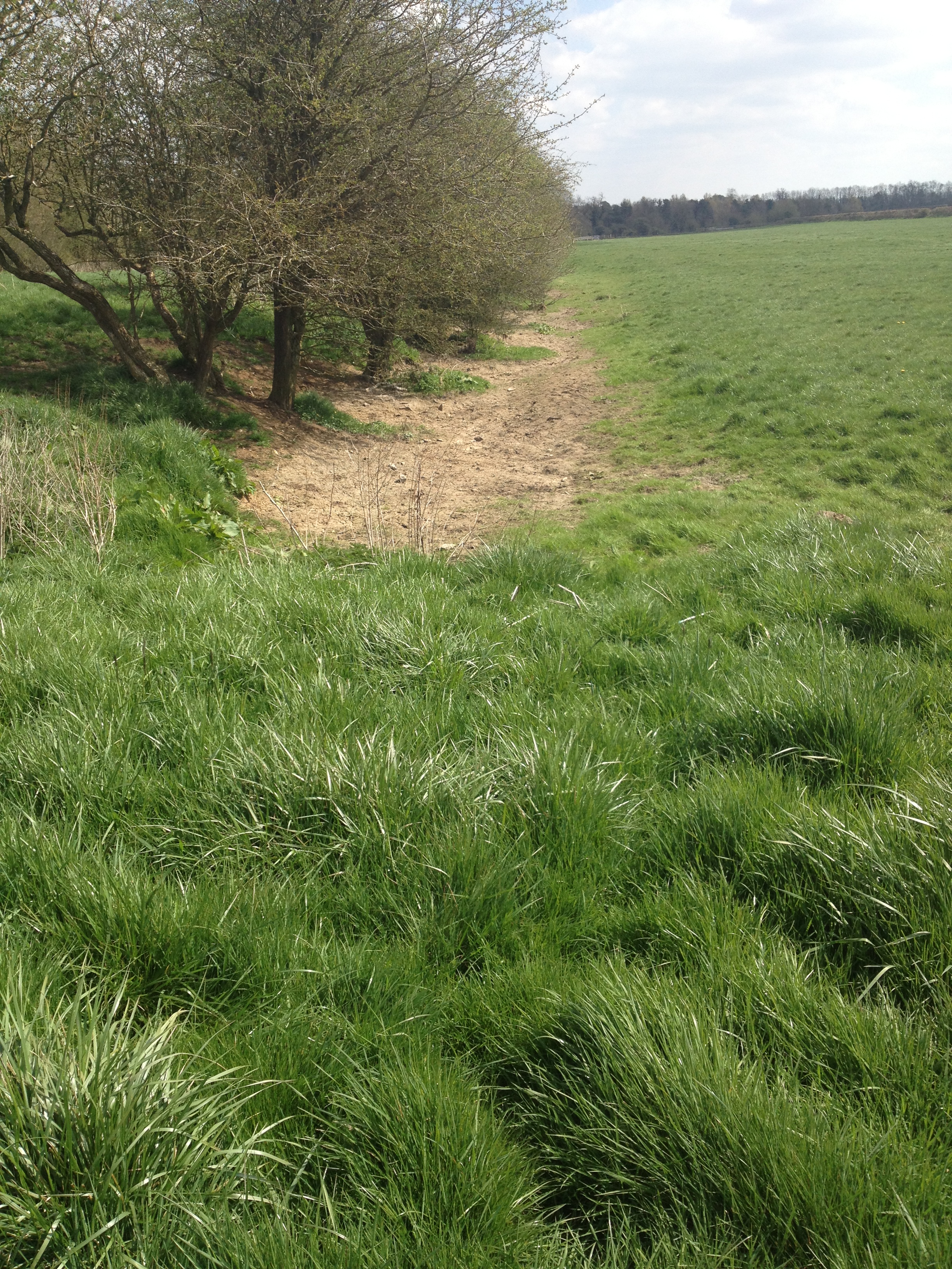
And The Thames riverbed stretches before you

Good description. Will try this